

Recomienda este artículo a tus amigos:
Colorado State Map
Rand McNally
Nuestros clientes opinan:

Colorado State Map
Rand McNally
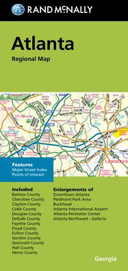
Rand McNally's Easy To Read State Folded Map is a must-have for anyone traveling in and around Colorado, offering unbeatable accuracy and reliability at a great price. Our trusted cartography shows all Interstate, U. S., state, and county highways, along with clearly indicated parks, points of interest, airports, county boundaries, and streets. The easy-to-use legend and detailed index make for quick and easy location of destinations. You'll see why Rand McNally folded maps have been the trusted standard for years. -Regularly updated, full-color maps. -Larger map with a bigger type size than the Rand McNally Folded Map. - Clearly labeled Interstate, U. S., state, and county highways. - Indications of parks, points of interest, airports, county boundaries, and more. - Mileage and driving times map. - Detailed index. - Convenient folded size. Coverage Area: Detailed maps of Boulder, Colorado Springs, Denver & Vicinity, Downtown Denver, Fort Collins, Greeley, Mesa Verde National Park, Pueblo, Rocky Mountain National Park.
| Medios de comunicación | Libros Hardcover Book (Libro con lomo y cubierta duros) |
| Publicado | 6 de agosto de 2021 |
| ISBN13 | 9780528024443 |
| Editores | Rand McNally |
| Genre | Maps & Guides |
| Dimensiones | 500 g (Peso (estimado)) |
| Lengua | English |
Mas por Rand McNally


![Cover for Rand McNally · A Pocket Atlas of the [world] [cartographic Material]: Presented to the Patrons and Friends of the Chicago & North-Western Ry. Co. With the Compliments of the Passenger Department (Paperback Book) (2021)](https://imusic.b-cdn.net/images/item/original/417/9781015179417.jpg?rand-mcnally-2021-a-pocket-atlas-of-the-world-cartographic-material-presented-to-the-patrons-and-friends-of-the-chicago-north-western-ry-co-with-the-compliments-of-the-passenger-department-paperback-book&class=scaled&v=1649334010)


Otros también han comprado
![Cover for Preben Hansen · Turen Går Til: Turen går til Californien & Vestlige USA (Sewn Spine Book) [5.º edición] (2021)](https://imusic.b-cdn.net/images/item/original/578/9788740063578.jpg?preben-hansen-2021-turen-gaar-til-turen-gaar-til-californien-vestlige-usa-sewn-spine-book&class=scaled&v=1623395637)
![Cover for J. K. Rowling · Harry Potter: Harry Potter 6 - Harry Potter og Halvblodsprinsen (Bound Book) [5.º edición] (2015)](https://imusic.b-cdn.net/images/item/original/277/9788702173277.jpg?j-k-rowling-2015-harry-potter-harry-potter-6-harry-potter-og-halvblodsprinsen-bound-book&class=scaled&v=1441302687)
![Cover for Olga Ravn · De ansatte (Sewn Spine Book) [1.º edición] (2018)](https://imusic.b-cdn.net/images/item/original/583/9788702265583.jpg?olga-ravn-2018-de-ansatte-sewn-spine-book&class=scaled&v=1521711504)
![Cover for Paludans Bilatlas over Europa 2016 (Spiral Book) [1.º edición] (2016)](https://imusic.b-cdn.net/images/item/original/473/9788772307473.jpg?2016-paludans-bilatlas-over-europa-2016-spiral-book&class=scaled&v=1532297840)
![Cover for Betty Edwards · Drawing on the Right Side of the Brain: A Course in Enhancing Creativity and Artistic Confidence: definitive 4th edition (Hardcover Book) [Main edition] (2013)](https://imusic.b-cdn.net/images/item/original/778/9780285641778.jpg?betty-edwards-2013-drawing-on-the-right-side-of-the-brain-a-course-in-enhancing-creativity-and-artistic-confidence-definitive-4th-edition-hardcover-book&class=scaled&v=1398870041)

![Cover for Kent Haruf · Eventide - Plainsong (Paperback Book) [Main Market Ed. edition] (2013)](https://imusic.b-cdn.net/images/item/original/457/9781447240457.jpg?kent-haruf-2013-eventide-plainsong-paperback-book&class=scaled&v=1396360108)


![Cover for Barbara Kingsolver · Demon Copperhead: Winner of the Women's Prize for Fiction (Paperback Book) [Main - Re-issue edition] (2023)](https://imusic.b-cdn.net/images/item/original/483/9780571376483.jpg?barbara-kingsolver-2023-demon-copperhead-winner-of-the-women-s-prize-for-fiction-paperback-book&class=scaled&v=1680172538)
![Cover for Disney · Carl Barks & Don Rosa Bind II (Hardcover Book) [1.º edición] (2020)](https://imusic.b-cdn.net/images/item/original/218/9788793840218.jpg?disney-2020-carl-barks-don-rosa-bind-ii-hardcover-book&class=scaled&v=1596799987)
Ver todo de Rand McNally ( Ej. Paperback Book , Map , Hardcover Book , Book y Spiral Book )