Recomienda este artículo a tus amigos:
Rand McNally Folded Map: Central United States Map
Nuestros clientes opinan:


Rand McNally Folded Map: Central United States Map
Rand McNally
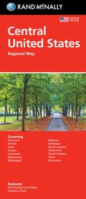
Rand McNally's folded map featuring the Central United States is a must-have for anyone traveling in and around this part of the country, offering unbeatable accuracy and reliability at a great price. Our trusted cartography shows all Interstate, state, and county highways, along with clearly indicated points of interest, airports, county boundaries, and more. You'll see why Rand McNally folded maps have been the trusted standard for years. -Regularly updated, full-color maps. -Clearly labeled Interstate, U. S., state, and county highways. -Detail maps of major cities, a mileage chart, and a Mileages & Driving Times Map. - Indications of parks, points of interest, airports, county boundaries, and more. -Easy-to-use legend. -Detailed index. Coverage Area: Arkansas, Illinois, Iowa, Kansas, Louisiana, Minnesota, Mississippi, Missouri, Nebraska, North Dakota, Oklahoma, South Dakota, Texas, and Wisconsin. Product Details: Measures 9.5 x 4.125 and folds out to 40 x 28. Scale: 1 = 43 miles.
| Medios de comunicación | Libros Map (Cartas terrestres o náuticas) |
| Publicado | 6 de agosto de 2021 |
| ISBN13 | 9780528024597 |
| Editores | Rand McNally |
| Dimensiones | 102 × 236 × 8 mm · 250 g (Peso (estimado)) |
| Lengua | Inglés |
Mas por Rand McNally
Mostrar todo


Más del mismo editor


![Cover for Rand Mcnally · Rand Mcnally Providence Street Map (Paperback Book) [Map edition] (2020)](https://imusic.b-cdn.net/images/item/original/153/9780528008153.jpg?rand-mcnally-2020-rand-mcnally-providence-street-map-paperback-book&class=scaled&v=1512788431)
Ver todo de Rand McNally ( Ej. Map , Paperback Book , Hardcover Book , Book y Spiral Book )