
Recomienda este artículo a tus amigos:
Family Maps of Pike County, Arkansas
Gregory a Boyd J.d.
Pedido desde almacén remoto
Nuestros clientes opinan:

Family Maps of Pike County, Arkansas
Gregory a Boyd J.d.
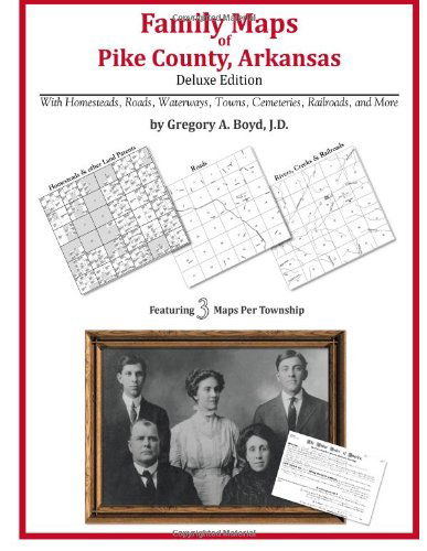
284 pages with 77 total maps Locating original landowners in maps has never been an easy task-until now. This volume in the Family Maps series contains newly created maps of original landowners (patent maps) in what is now Pike County, Arkansas, gleaned from the indexes of the U. S. Bureau of Land Management. But it offers much more than that. For each township in the county, there are two additional maps accompanying the patent map: a road map and a map showing waterways, railroads, and both modern and many historical city-centers and cemeteries. Included are indexes to help you locate what you are looking for, whether you know a person's name, a last name, a place-name, or a cemetery. The combination of maps and indexes are designed to aid researchers of American history or genealogy to explore frontier neighborhoods, examine family migrations, locate hard-to-find cemeteries and towns, as well as locate land based on legal descriptions found in old documents or deeds. The patent-maps are essentially plat maps but instead of depicting owners for a particular year, these maps show original landowners, no matter when the transfer from the federal government was completed. Dates of patents typically begin near the time of statehood and run into the early 1900s. What's Mapped in this book (that you'll not likely find elsewhere) . . . 4378 Parcels of Land (with original landowner names and patent-dates labeled in the relevant map) 30 Cemeteries plus . . . Roads, and existing Rivers, Creeks, Streams, Railroads, and Small-towns (including some historical), etc. What YEARS are these maps for? Here are the counts for parcels of land mapped, by the decade in which the corresponding land patents were issued: Decade Parcel-count 1820s 4 1830s 117 1840s 118 1850s 482 1860s 654 1870s 143 1880s 765 1890s 539 1900s 1143 1910s 356 1920s 55 What Cities and Towns are in Pike County, Arkansas (and in this book)? Abner (historical), Anderson (historical), Antoine, Arp (historical), Ball (historical), Billstown, Bowen, Brocktown (historical), Caney Valley, Cooleyville, Cooper (historical), Crawford (historical), Daisy, Delight, Dunlap (historical), Elk (historical), Glenwood, Grandfield, Helbig (historical), Highland, Hopewell (historical), Kimberley, Kirby, Langley, Lissie (historical), Lodi, Maxwell (historical), Mount Moriah, Murfreesboro, Nathan, Newhope, Norvelle (historical), Nutts, Pike City, Piney Grove, Pisgah, Pleasant Home (historical), Rabell (historical), Rock Creek (historical), Rosboro, Roy, Salem, Shawmut, Stanley (historical), Star of the West (historical), Stelltown, Stephenson (historical), Wright (historical), Zebulon (historical)
| Medios de comunicación | Libros Paperback Book (Libro con tapa blanda y lomo encolado) |
| Publicado | 20 de mayo de 2010 |
| ISBN13 | 9781420312133 |
| Editores | Arphax Publishing Co. |
| Páginas | 292 |
| Dimensiones | 213 × 16 × 276 mm · 684 g |
| Lengua | English |


