Recomienda este artículo a tus amigos:
Hiking & Trekking around Copacabana Isla del Sol (Bolivia), Lake Titicaca Coast Both Sides of the Border, Cerro Khapia (Peru) Topographic Map Atlas 1
Sergio Mazitto
Pedido desde almacén remoto
Nuestros clientes opinan:

Hiking & Trekking around Copacabana Isla del Sol (Bolivia), Lake Titicaca Coast Both Sides of the Border, Cerro Khapia (Peru) Topographic Map Atlas 1
Sergio Mazitto
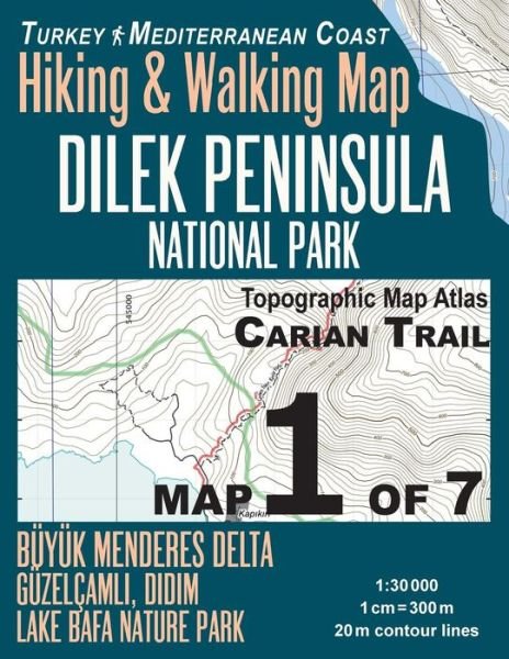
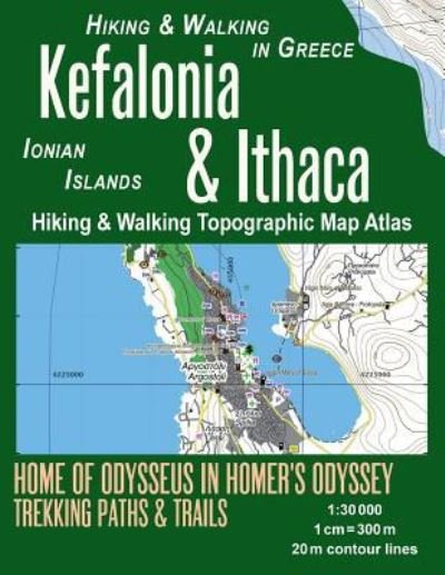
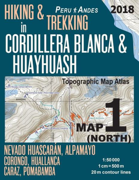
Updated 2018 edition. Detailed topographic map 1:50.000 & 20 meter contours for hiking and trekking, printed as an atlas book (with overlapping pages).
Covers a fragment of the Lake Titicaca coast close to the town of Copacabana as well as the nearby islands including Isla del Sol. Both sides of the border including the Cerro Khapia Landscape Reserve in Peru (Reserva Paisajistica Cerro Khapia) as well as the Peruvian towns of Pomata & Yunguyo and Desaguadero, straddling the border. On the Bolivian side, the map includes the area around the towns of San Pedro de Tiquina, Jankoamaya, Santiago de Huata, Achacachi along with the islands of Anapia, Suana, Taquiri, Suriqui and others.
20 meter contour lines, road network, trails & paths, transportation, food, campsites, shelters, guest houses & hotels. Mercator projection with both UTM and WGS84 coordinate grids.
The map scale of 1:50000 (1 cm = 500 meters) provides a wealth of detail while keeping low the weight of the atlas itself. The large page format of 8.5x11in minimizes page count and along with an overlapping map design allows for comfortable navigation.
The details included in the topographic maps of this atlas were specifically selected to be useful for trekkers, hikers and walkers of all interests, and make it easy to plan and enjoy both short excursions and hikes as well as long multi-day adventures along the main marked routes and/or adjacent trails and paths, which are also shown on the maps.
With this ultralight atlas you will always have a detailed, reliable, information-rich, battery-independent, shatter-proof map for your adventure.
| Medios de comunicación | Libros Paperback Book (Libro con tapa blanda y lomo encolado) |
| Publicado | 1 de marzo de 2018 |
| ISBN13 | 9781986087438 |
| Editores | Createspace Independent Publishing Platf |
| Páginas | 46 |
| Dimensiones | 216 × 280 × 3 mm · 172 g |
| Lengua | English |